
Glacier National Park’s North Circle Loop Backpacking Guide
/
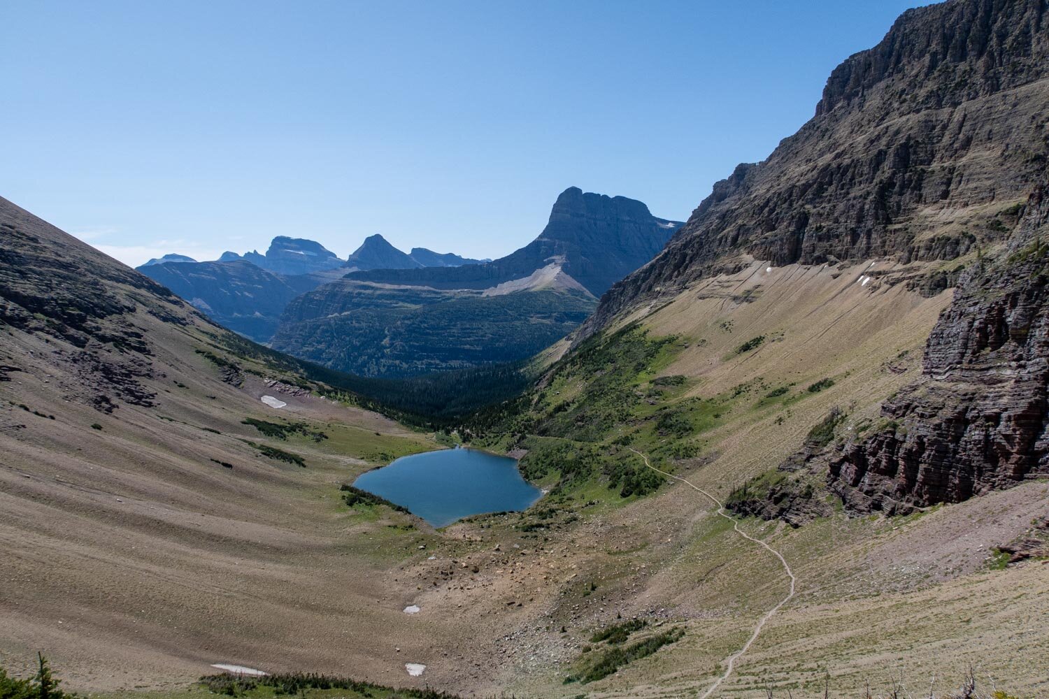
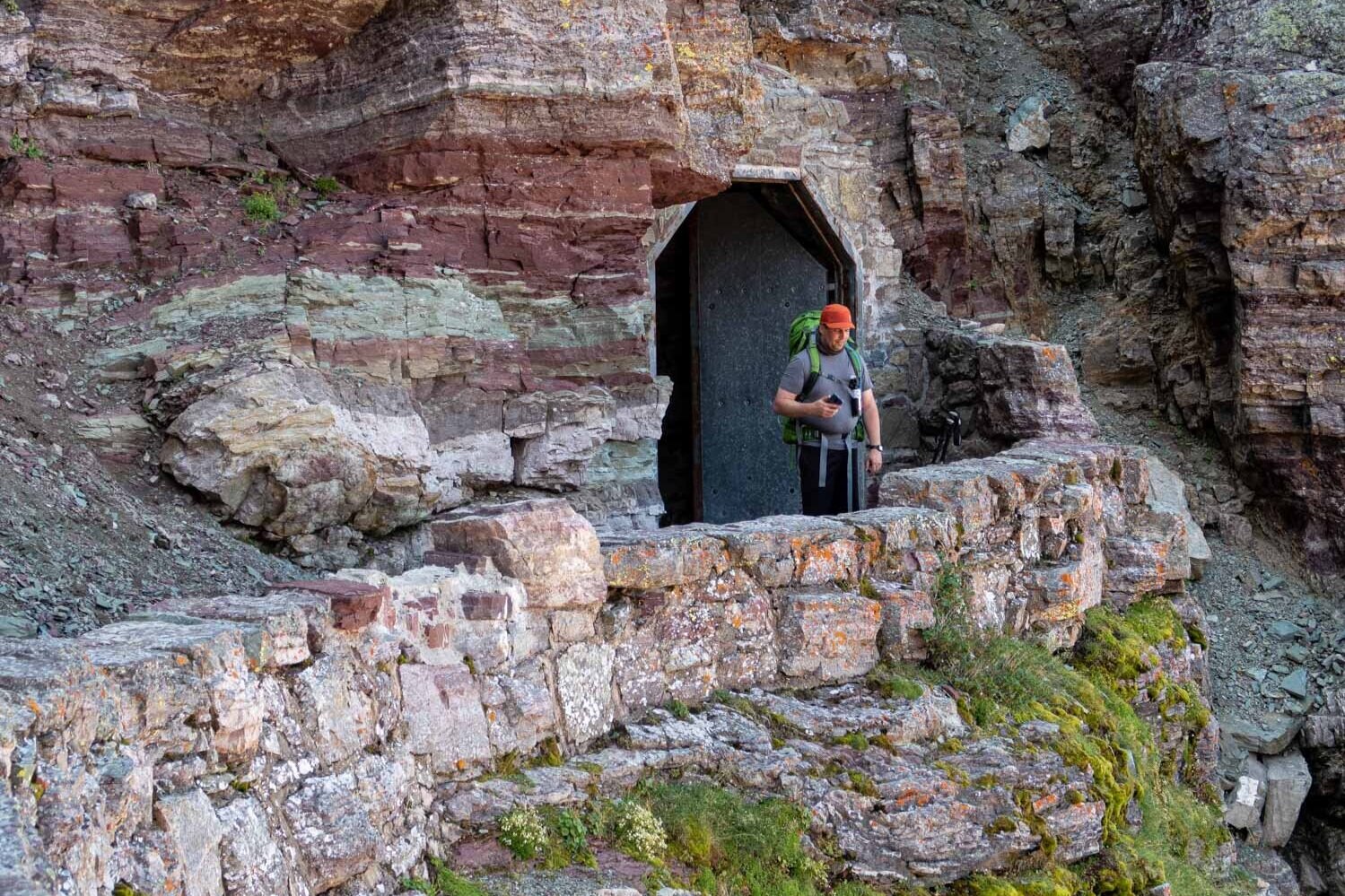
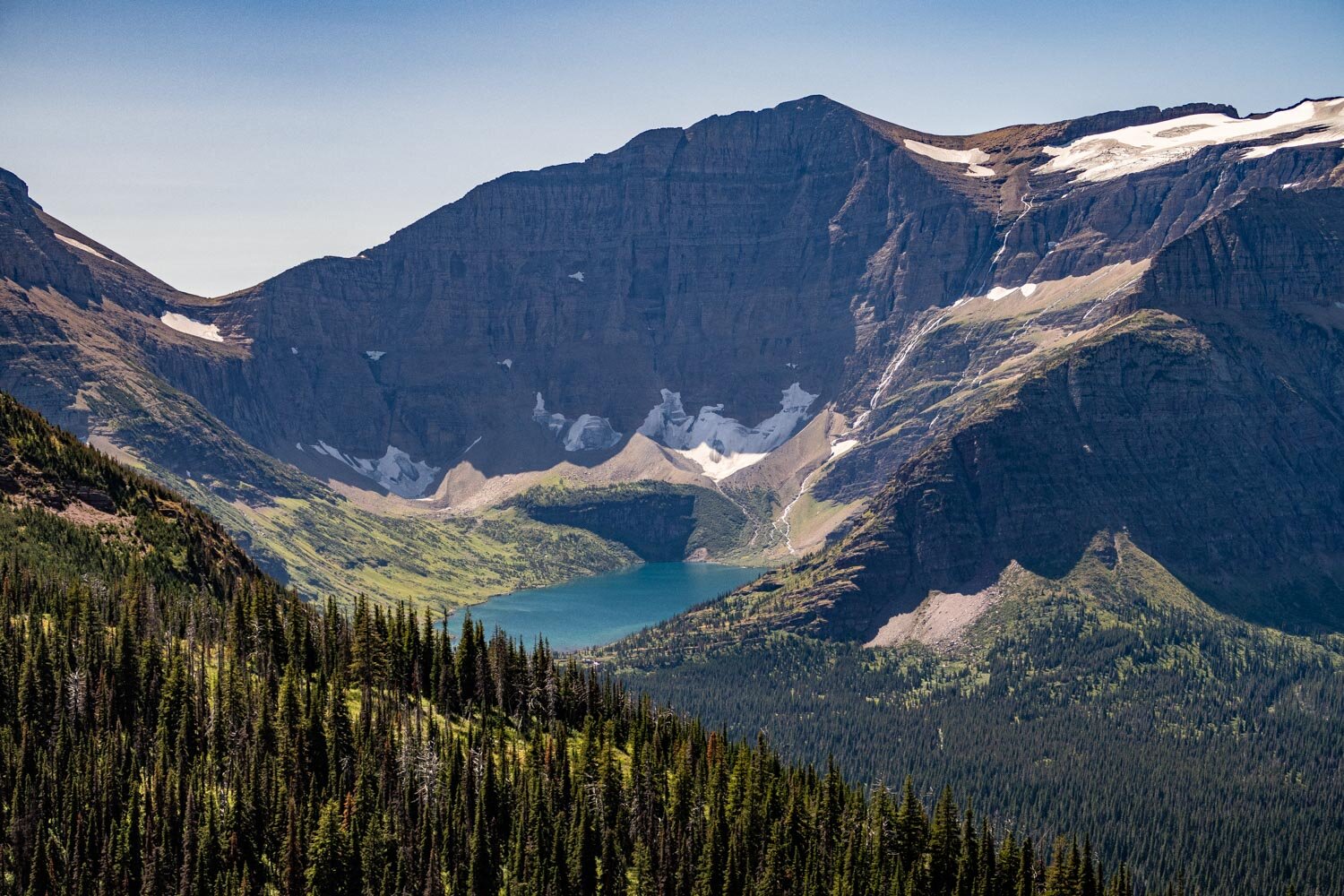
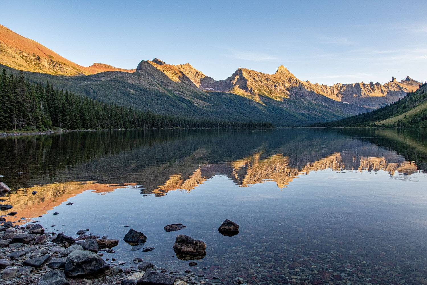
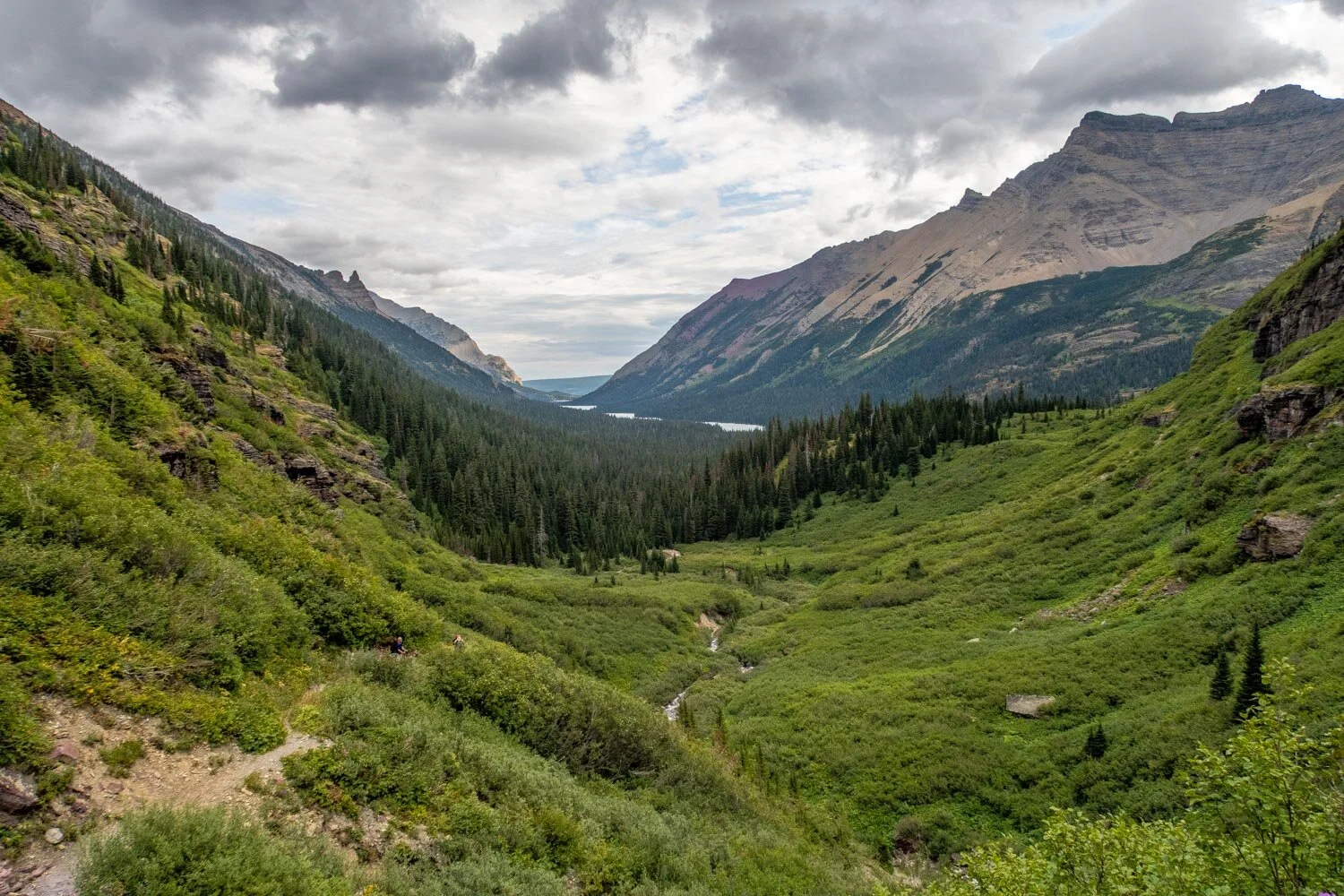
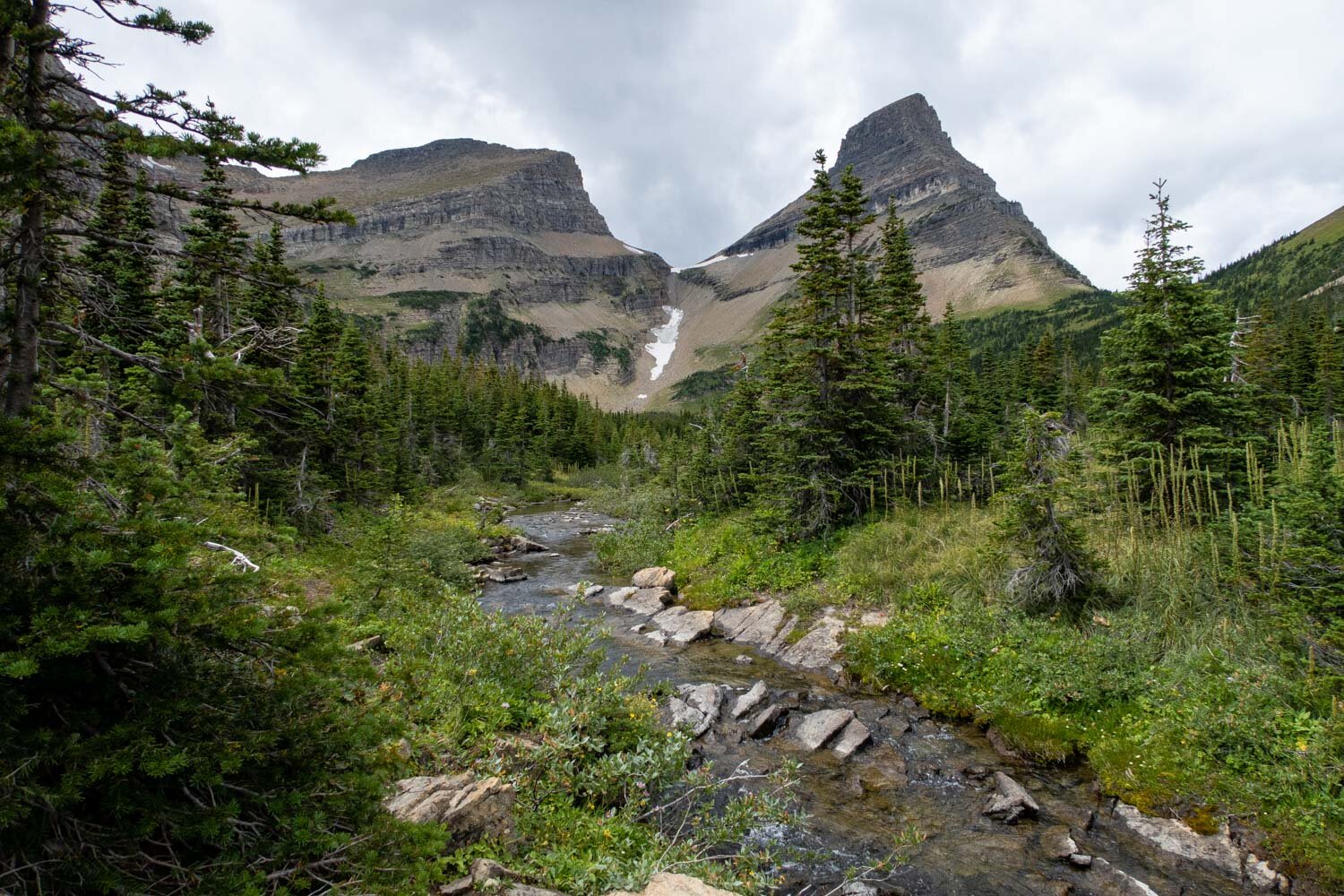
Stoney Indian Pass
This article may contain affiliate links.
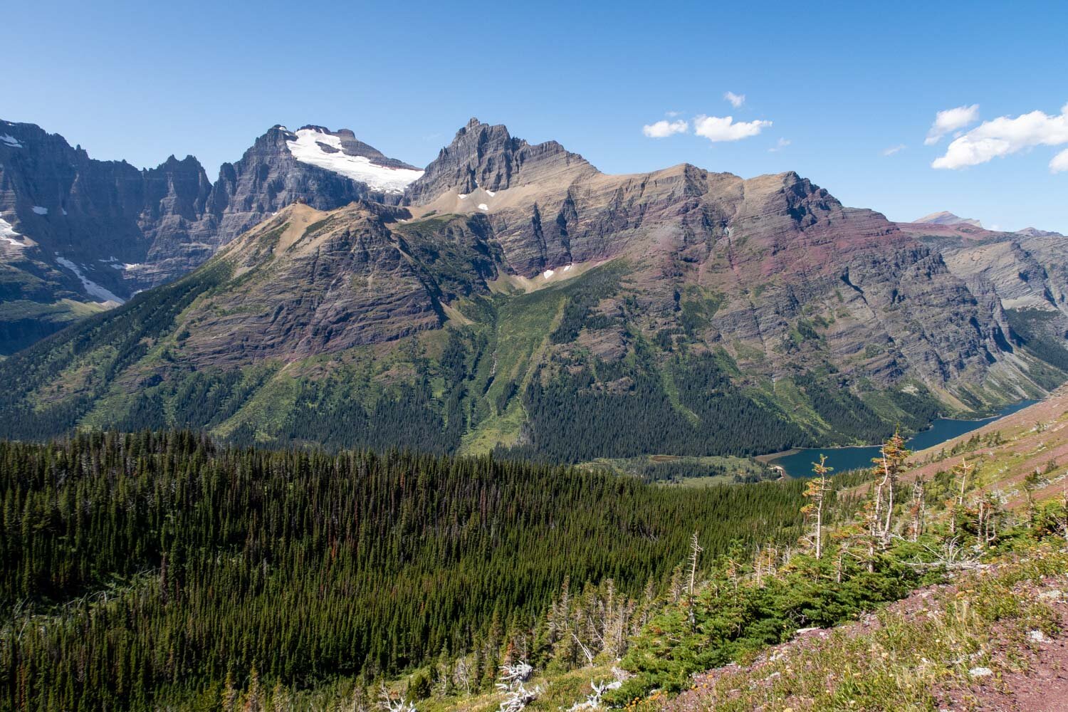
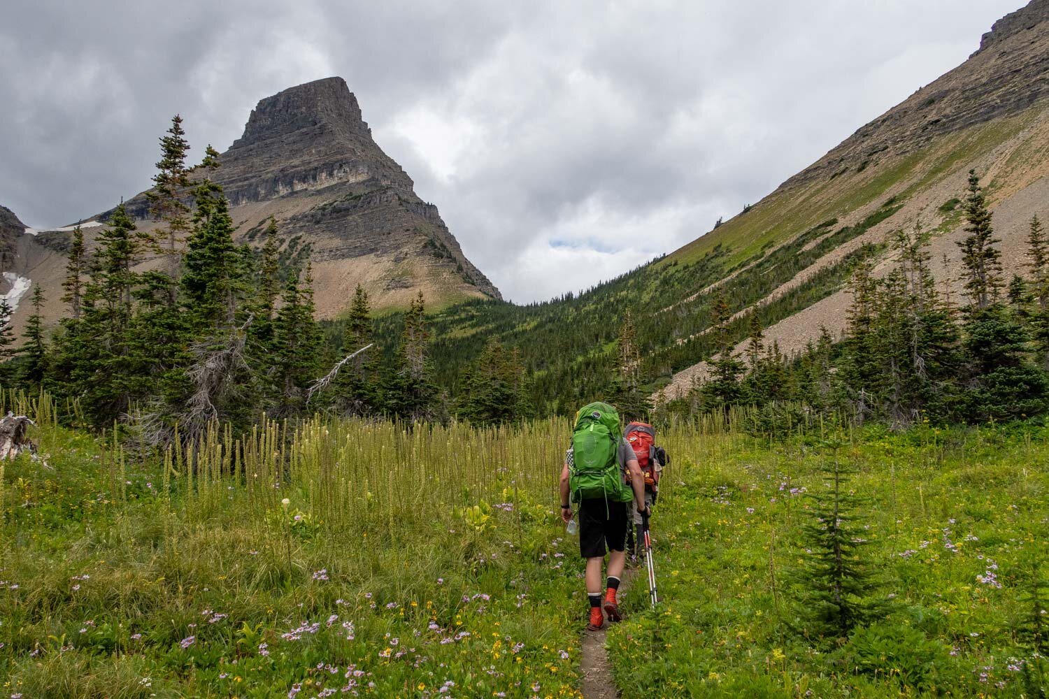
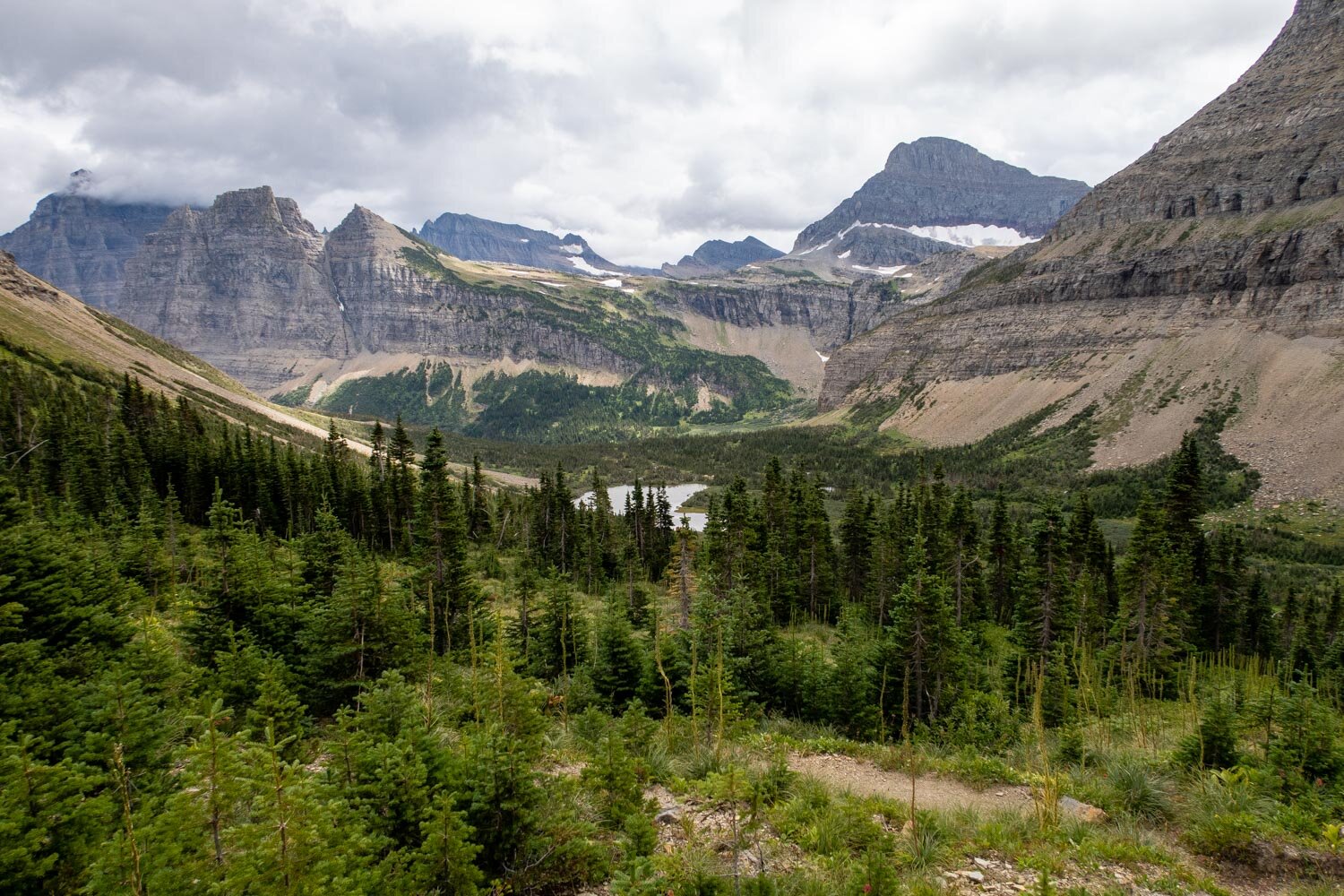
If you’re looking for the backpacking trip of a lifetime, look no further than the North Circle Loop in Glacier National Park, Montana. It’s a 52-mile route that offers the most incredible scenery in all of North America. You will get to hike through lush forest valleys, traverse high mountain passes, camp near pristine reflective lakes, and have the unique opportunity to pass through the Ptarmigan Tunnel. If that wasn’t enough for you, there’s the possibility you could see wildlife like big horn rams, grizzly bears, mountain goats, moose, gray wolfs, as well as rare animals like wolverines and Canadian Lynxes. With such a vast ecosystem, it’s no wonder they refer to Glacier as the “Crown of the Continent”.
In this backpacking guide I will help you to plan and prepare for what you will encounter on this route and help you navigate through the extensive permit process so you will spend less time worrying and more time looking forward to your backpacking adventure.
Trail Facts
Length: 52 Miles
Duration: 5-7 Days
Elevation Gain: Over 12,000 Feet
Peak Elevation: 7,400 Feet
Best Season to Hike: Late July to Mid September
Difficulty Level: Strenuous
Bear Canisters: Not Required
Permits: Required
Dogs: Not allowed
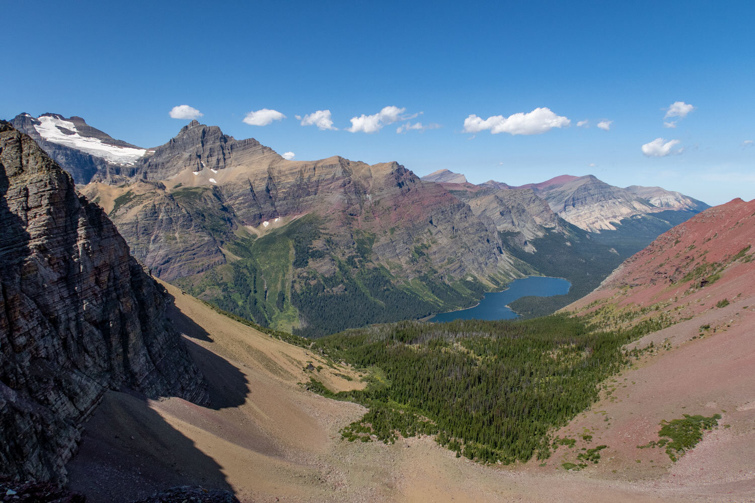
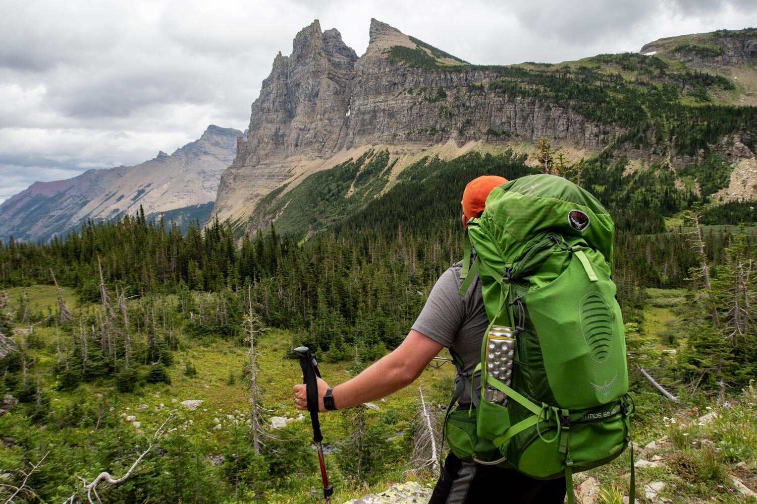
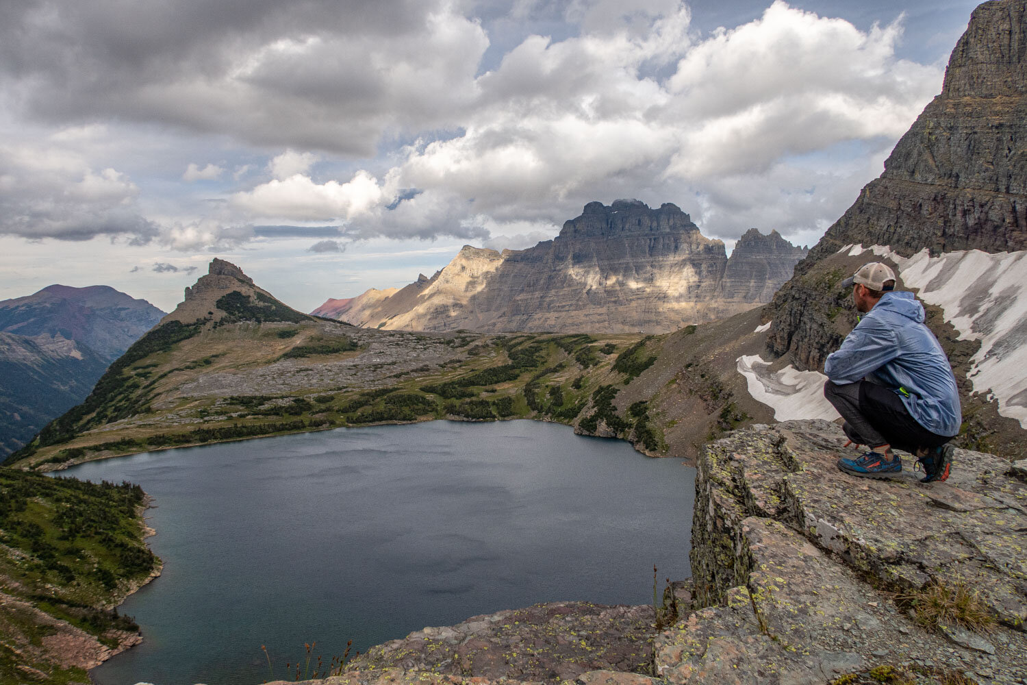
Highlights
Expansive Mountain Views
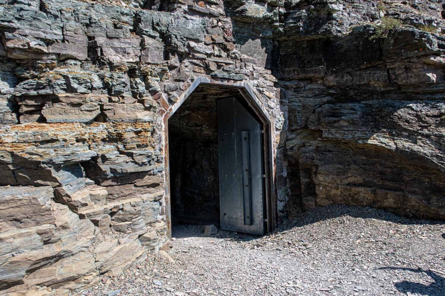
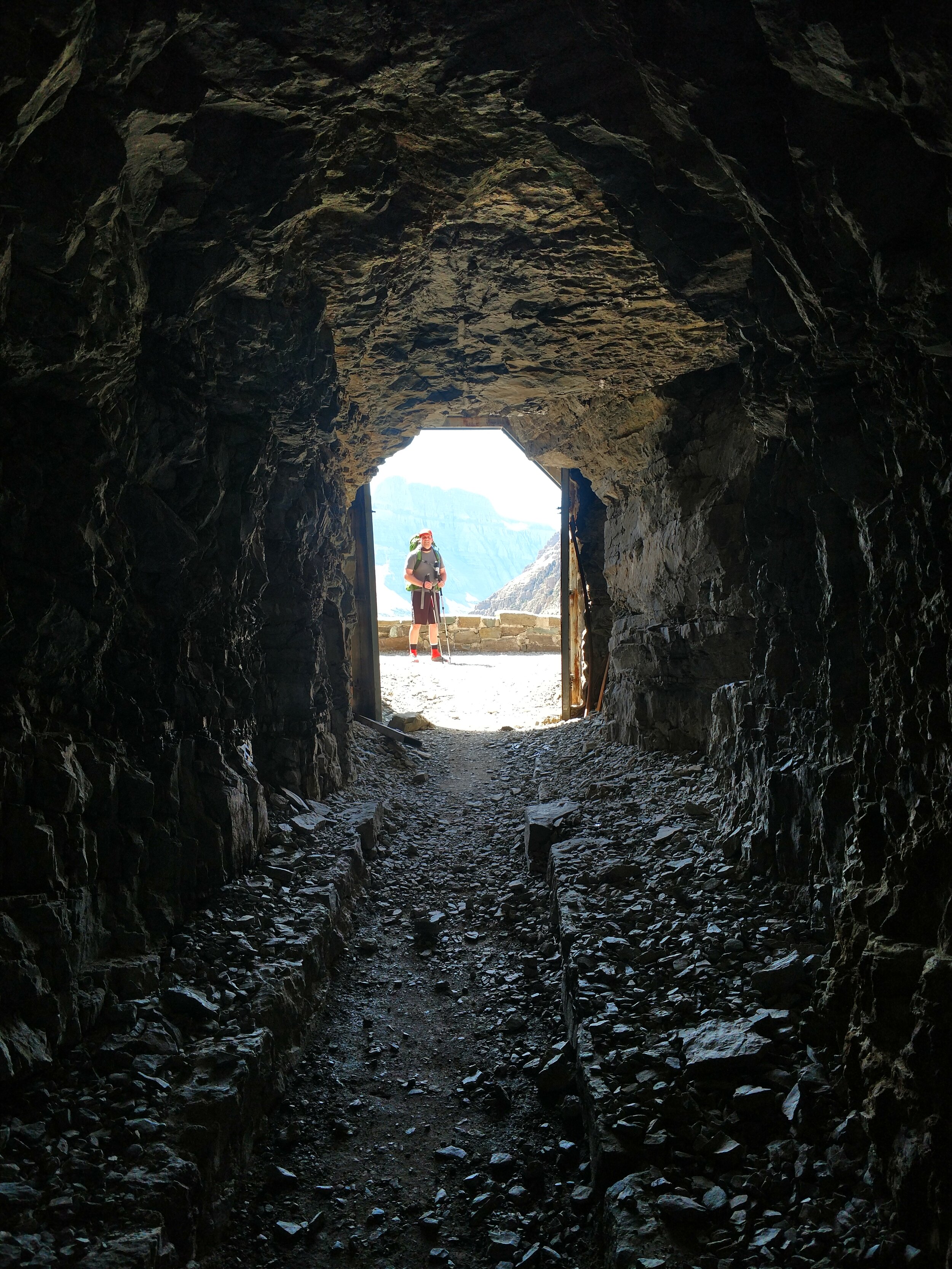
Ptarmigan Tunnel
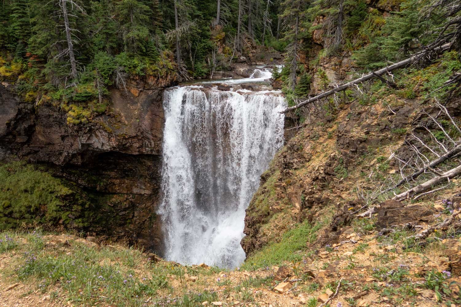
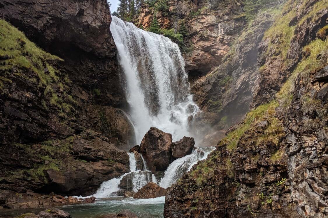
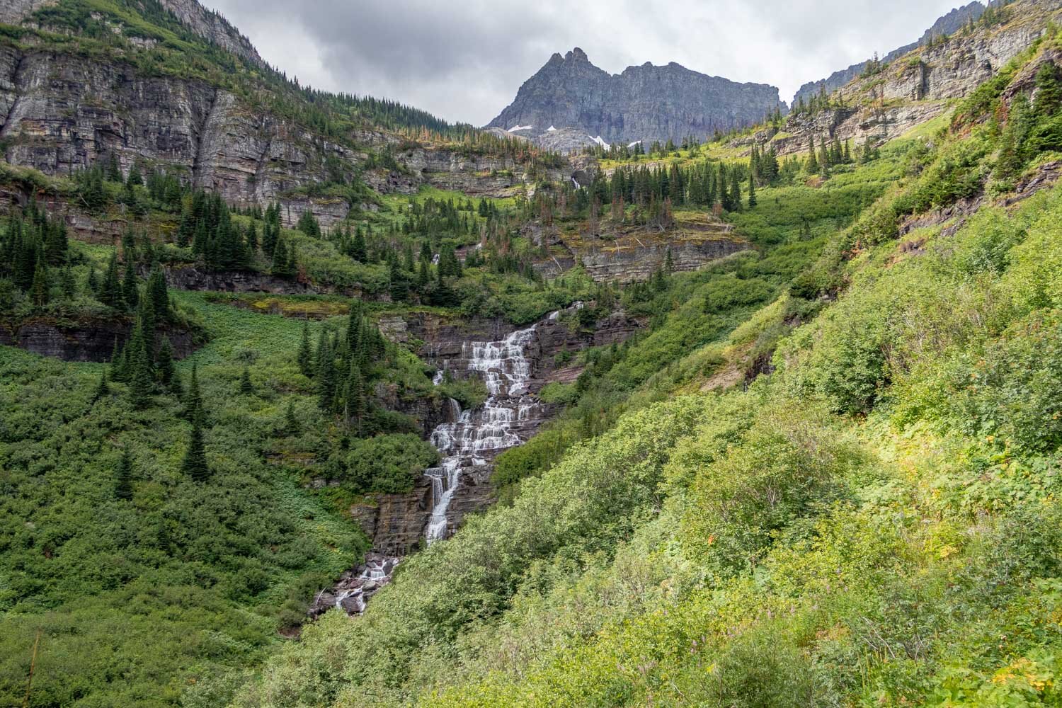
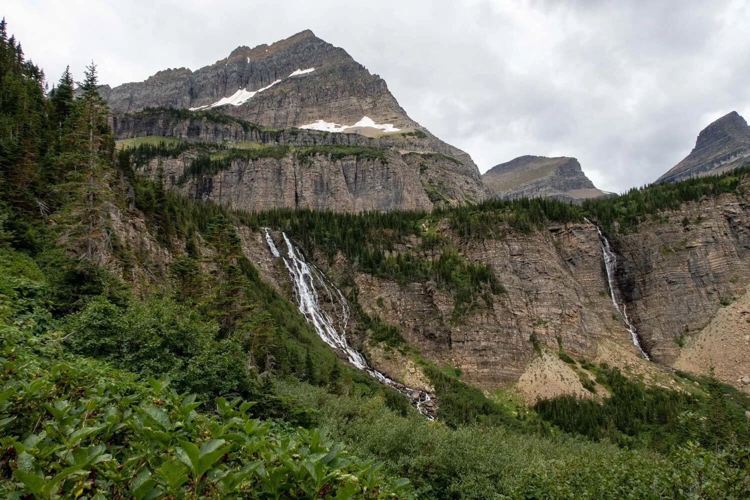
Amazing Waterfalls
Abundance of Wildlife
Dense Forests
Pristine Mountain Lakes
Wildflowers
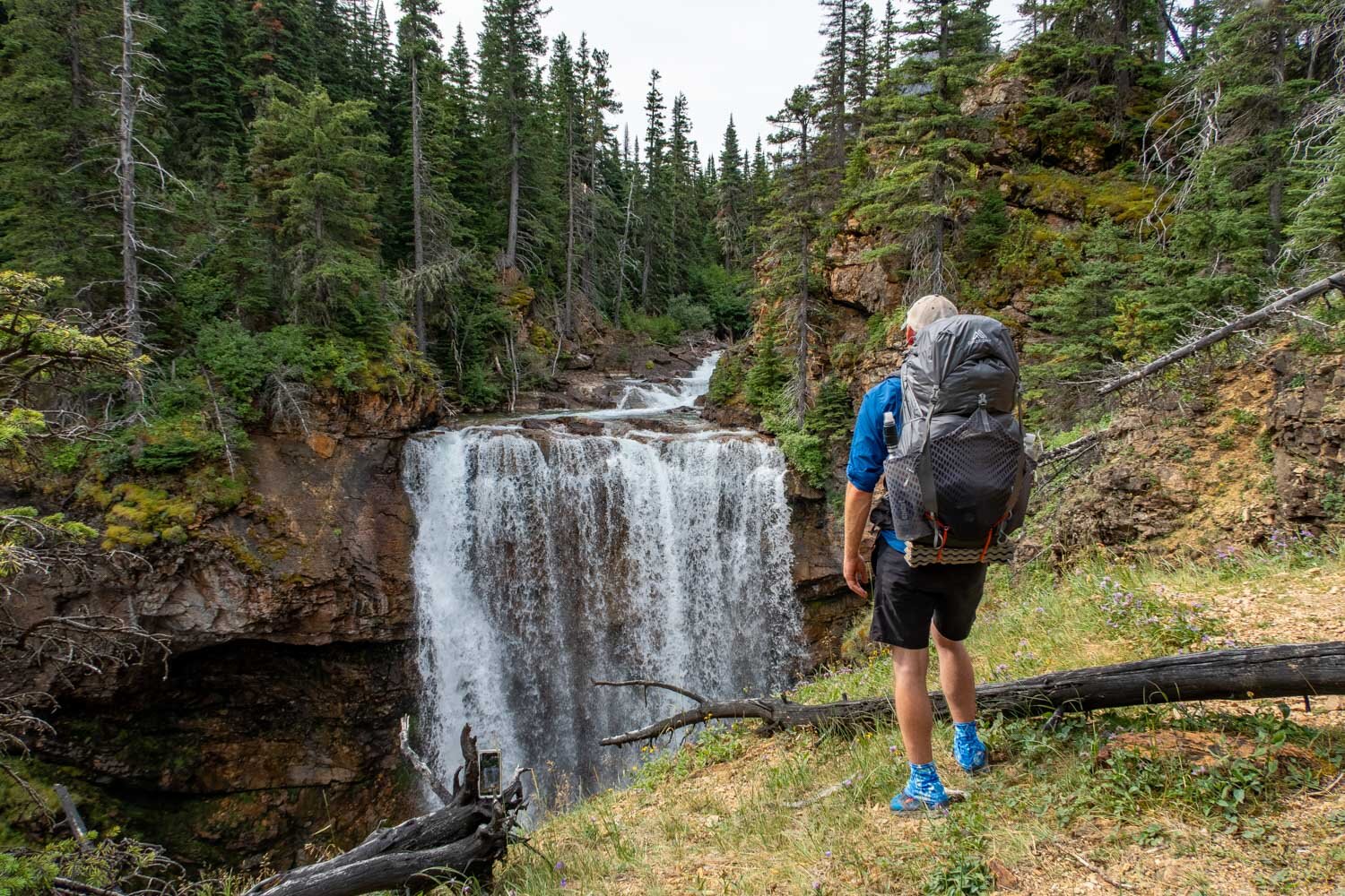
dawn Mist Falls
Maps
215 National Geographic (Glacier and Waterton Lakes National Parks) Map: For finding your way, I recommend using the National Geographic waterproof map. It will provide you with elevation profiles, campsite locations, points of interest, and water sources. Compared to other National Geographic maps, this map doesn’t have the trail mileage on it, so be sure to write it in prior to your trip. Mileage can be found on the Glacier National Park backcountry campsite map.
AllTrail App: For backpackers who prefer digital maps to navigate with, the AllTrails app is great. It uses your mobile phone’s GPS to track your position on the route. You’ll find the North Circle Loop there, along with over 400,000 other trails. The app provides you with elevation profiles, mileage, campsites, water sources, and points of interest.
Best Time to Go
From year to year conditions vary, but generally the backpacking season in Glacier is from late July to mid September. The reason the season is so short is due to snow lingering on the trails at high elevation.
Also, this trail is one of the most sought-after backpacking routes to apply for in the park, so to avoid the crowds and to be able to secure a permit, the later in the season you can go the better. My friends and I backpacked this route in late August and there was not a ton of people on the trail, but most of the backcountry campsites were filled.

Glacier National Park’s waterton valley
How to fly there
Glacier Park International Airport (FCA): This is the closest airport to Glacier. It’s located in Kalispell, MT which is a 2 hour and 41 minute drive from the airport to the Many Glacier area where the trailhead and lodging is.
Missoula International Airport: This is another airport option. It’s located in Missoula, MT which is a 4 hour and 36 minute drive to Many Glacier area. The benefit of flying into this airport is that usually you will find the most affordable tickets compared to everywhere else.
Parking
Parking is readily available in front of the Swiftcurrent Motor Inn. In peak season, this parking lot can be full at times. Their is an additional 20 parking spaces, located at the Iceberg Ptarmigan Trailhead. Click the links provided to see the exact locations of the parking areas or refer to the map below.
Places to Eat
Before or after your hike, you may want to have a good meal. Here are to options in the Many Glacier area:
Nell’s at Swiftcurrent: This restaurant serves classic Americana style cuisine with a focus on healthy and locally sourced ingredients. It’s conveniently located near the trailheads in Many Glacier area. The food prices are very reasonable too.
The Ptarmigan Dinning Room at the Many Glacier Hotel: This place is an upscale Americana style restaurant set alongside the Swiftcurrent Lake and against a panoramic backdrop of peaks and vistas. It’s only a short drive to or from the trailheads in Many Glacier area. The food prices are expensive, so eating here would be a splurge
Lodging
Depending on where you are flying in from, you may have a long tiresome day of travel. Since the permit office closes at 4:30 pm anyway and you’ll want to be well rested before you start your trek, I’d suggest that you sleep the first night in a real bed. Here are some suggestions:
Swiftcurrent Motor Inn: This place is located in the Many Glacier area with trailheads right outside their front doors. It’s made up of rustic cabins and motor inn rooms. The cabins are available with or without a private bathroom. If you choose one without, a bathroom and shower facility is located within a short walking distance from the cabins. All cabins are heated, linens are provided, and laundry facilities are available for a fee. For the motor inn guest rooms, you get all the usual amenities associated with a hotel stay.
Many Glacier Hotel: This hotel is situated on the shores of Swiftcurrent Lake in the Many Glacier area and only a short drive to or from the trailheads. This secluded, five-story hotel offers lakeside, deluxe, standard and value lodging options. All guest rooms at Many Glacier Hotel are rustic, yet comfortable. The rooms offer many amenities, but no televisions or air conditioning. All guest rooms do have private bathrooms.
St. Mary Village/East Glacier KOA Campground: This campground is located in the town of St. Mary which is a 37 mile drive to Many Glacier area. Here you can stay in affordable camping cabins with panoramic views of Glacier’s mountain peaks. The cabins are available with or without a private bathroom. Like a typical campground bathroom and shower facilities are located within a short walking distance. All the cabins are heated, but no linens are provided. The campground has an outside Grill that serves up homemade breakfasts, pizzas and dinners to feed that hiking hunger.
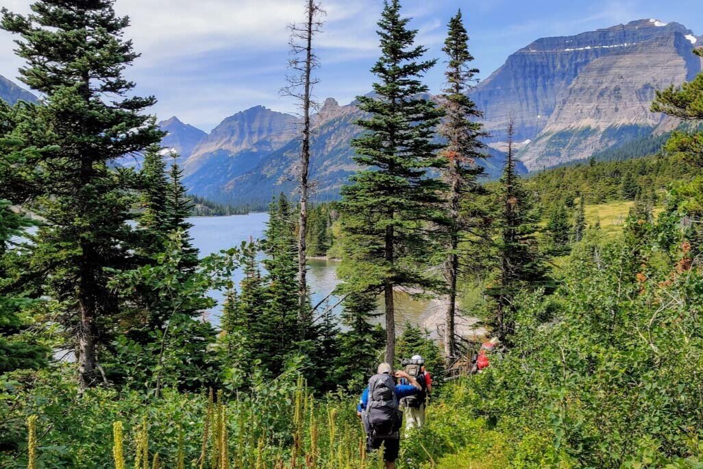
stopping to soak in the views of Glacier National Park
Backpacking Supplies
For stocking up on backpacking supplies, there are outfitters and camp stores on both the west and east side of the park. Since you’re not permitted to fly with items like bear spray and gas canisters, you can find those items at these stores:
Glacier Outfitters: There are two locations on the west side of the park. Ones located at the FCA airport and the other one is at the Apgar village, which is inside the national park. Instead of just buying gear, you can also rent stuff here as well, like bear spray.
Trail and Creek Outfitters: This place is on the east side of the park in the town of St. Mary. You can stock up on Mountain House freeze dried meals, gas canisters, bear spray, and many other items.
Swiftcurrent Motor Inn Campstore: This place is located right in the Many Glacier area on the east side of the park. Here you will find limited backpacking supplies, but they do have bear spray.
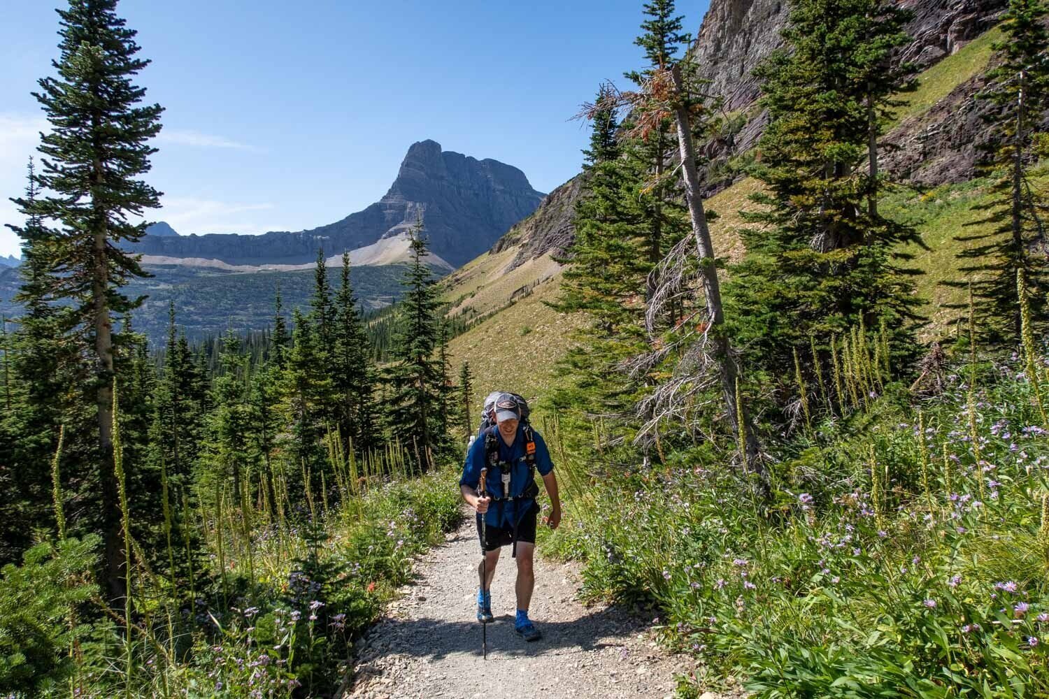
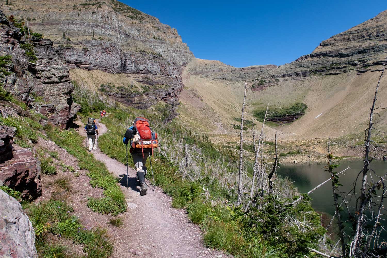
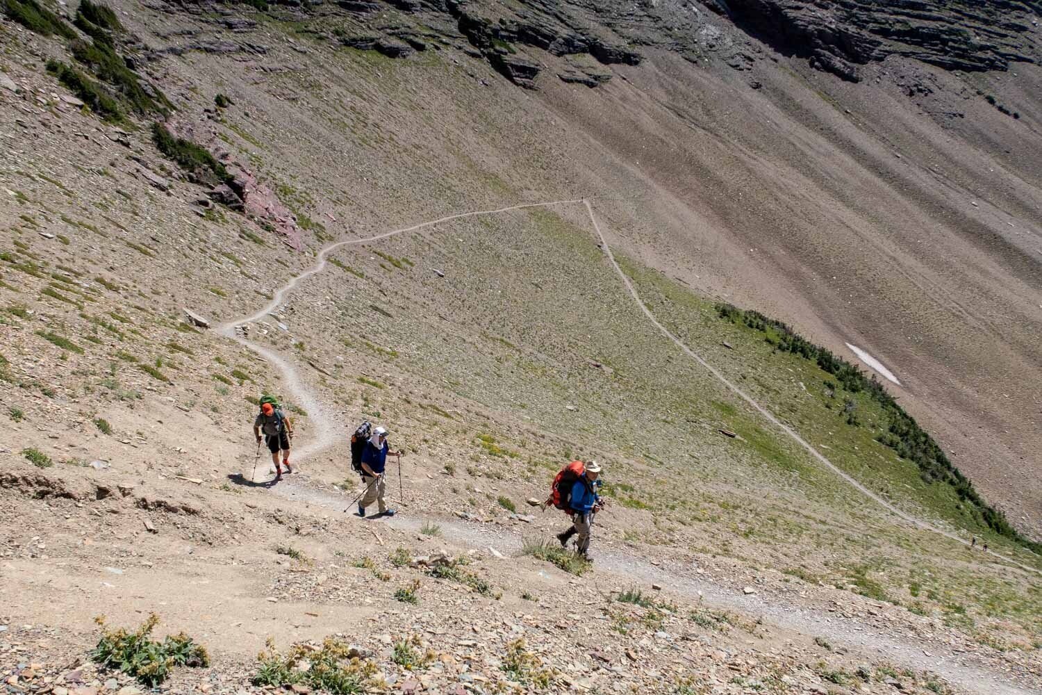
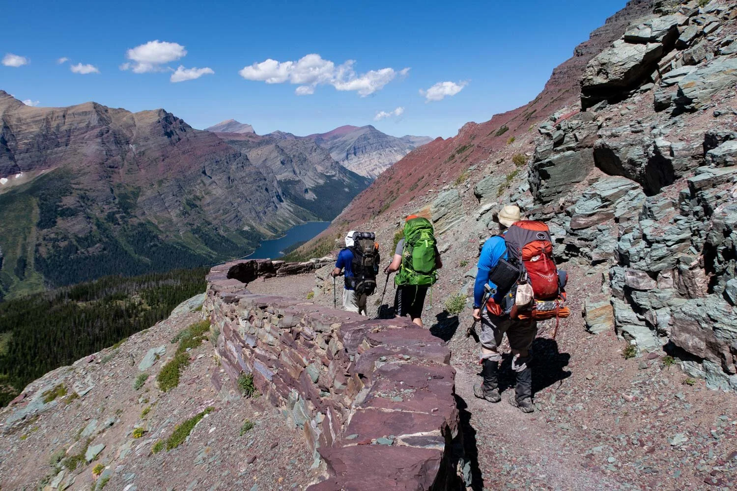
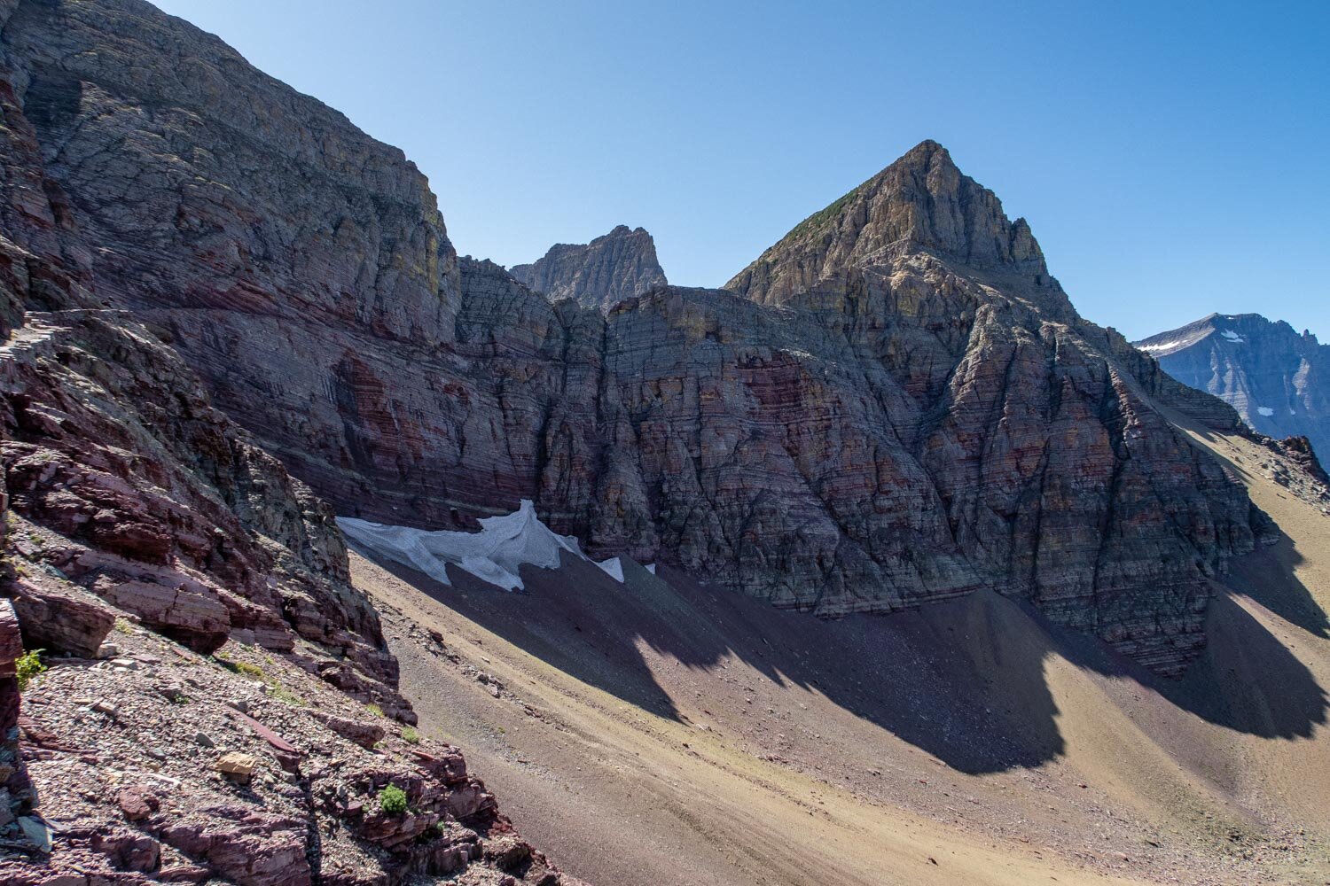
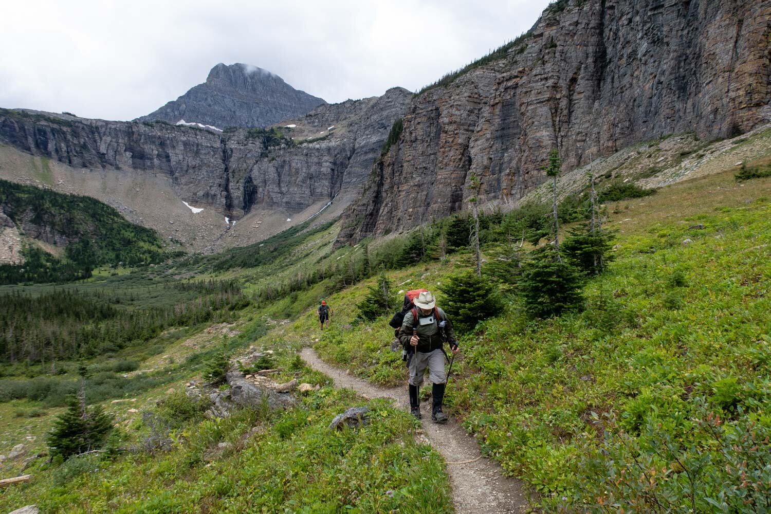
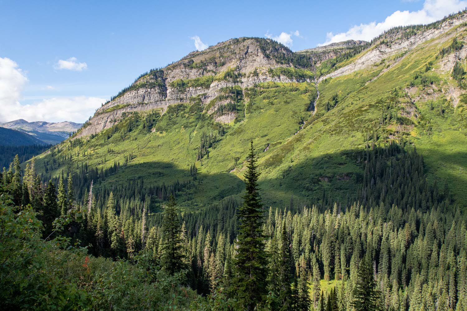
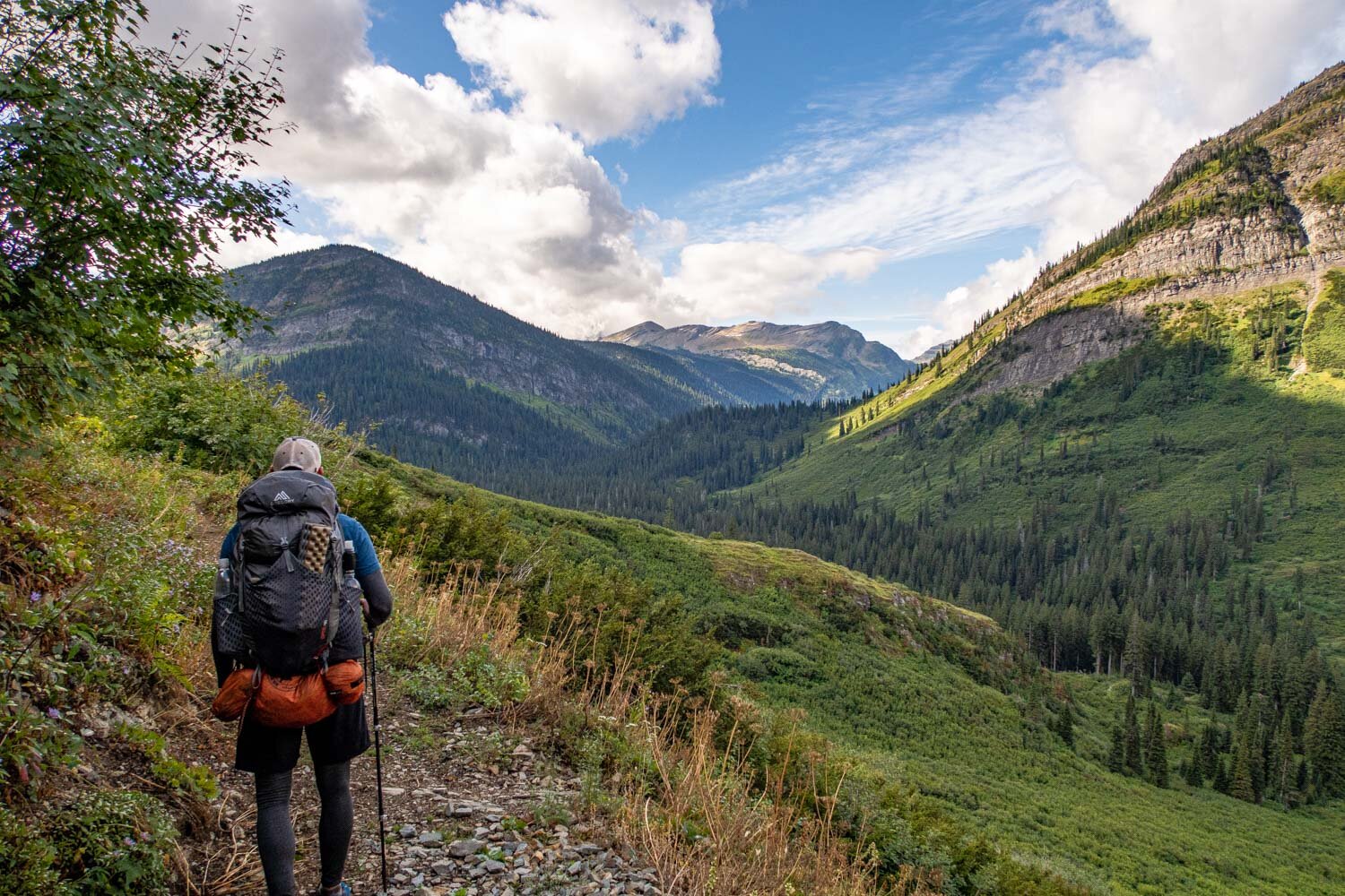
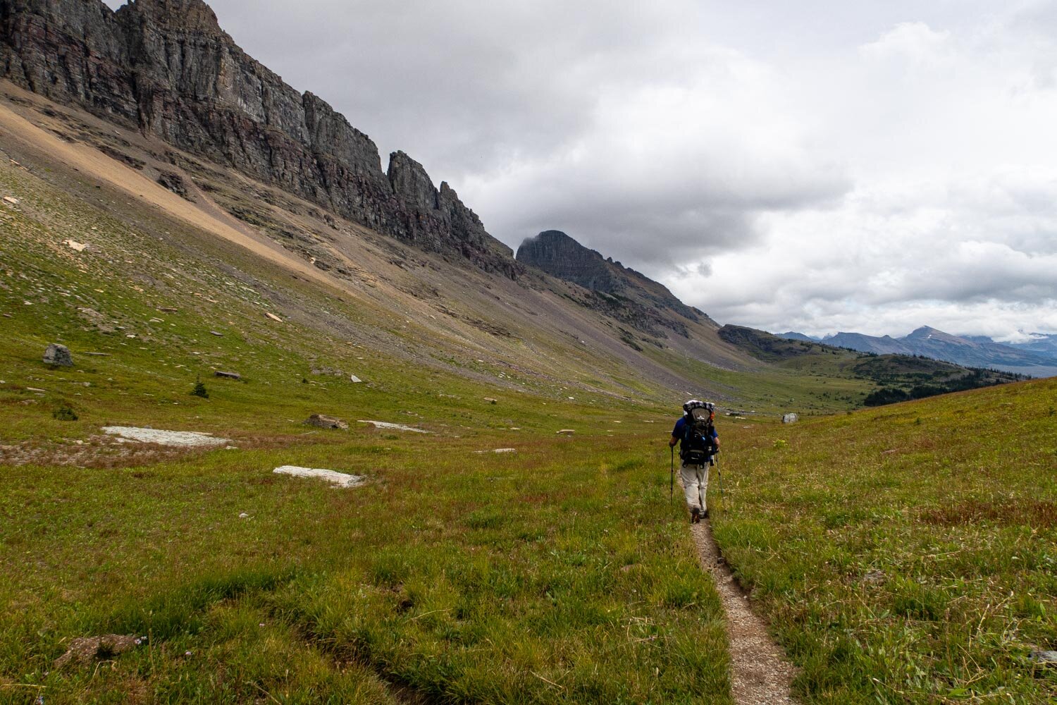
Terrain
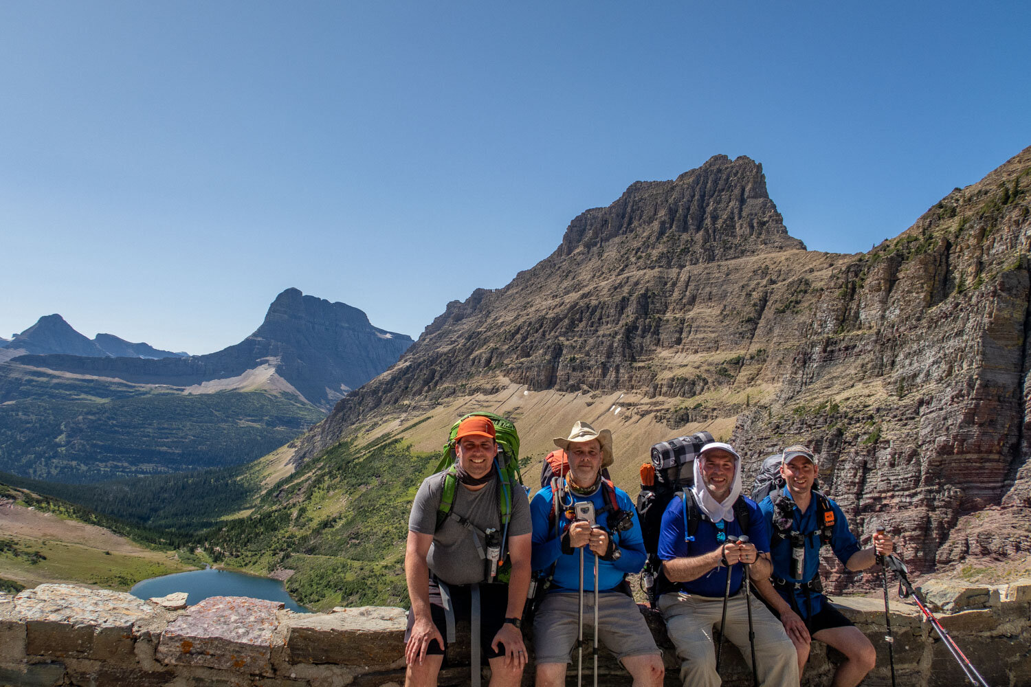
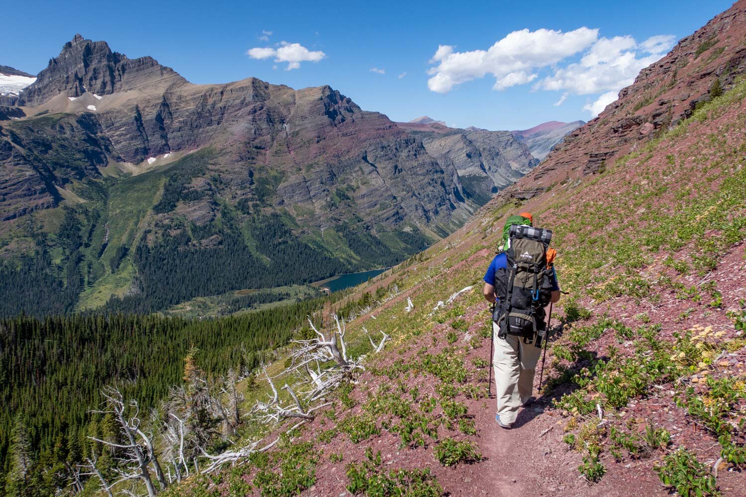
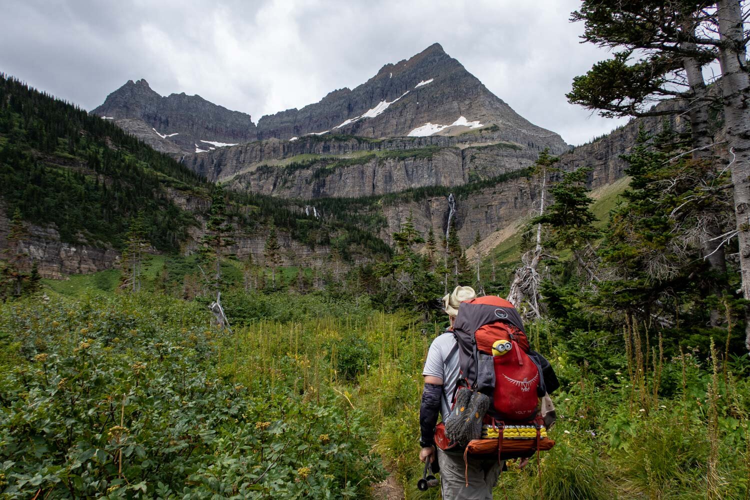
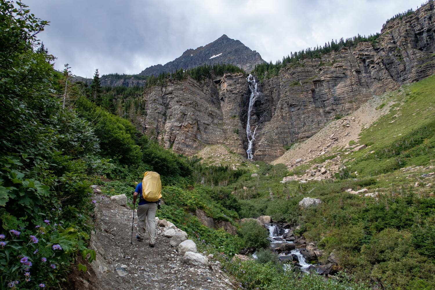
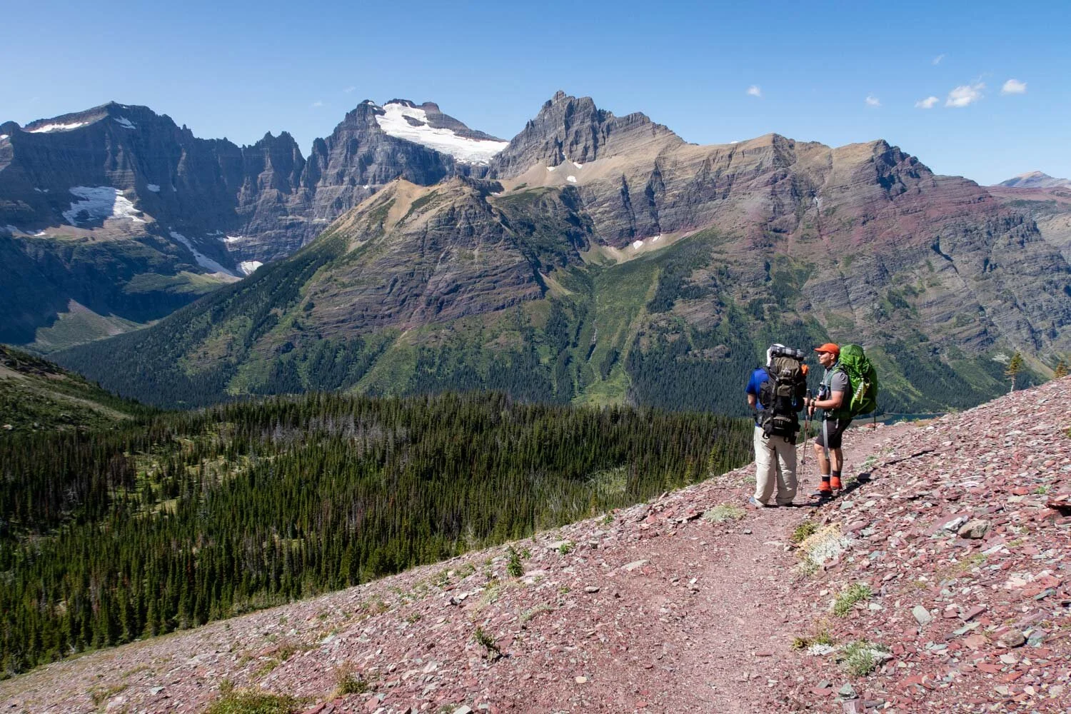
The North Circle Loop’s terrain can be challenging at times, with many steep climbs. Throughout the route you will climb over 12,000’ of cumulative elevation gain. This is due to several steep mountain passes that you will have to climb up over. For instance, hiking up to the Ptarmigan Tunnel involves a 2000’ climb from the trailhead. Another area that will test your fitness is the climb up to Stoney Indian Pass. This involves a 1900’ ascent to the top with many switchbacks. Also, if you decide to do the entire loop clockwise, the climb up Swiftcurrent Pass would be an additional 1770’.
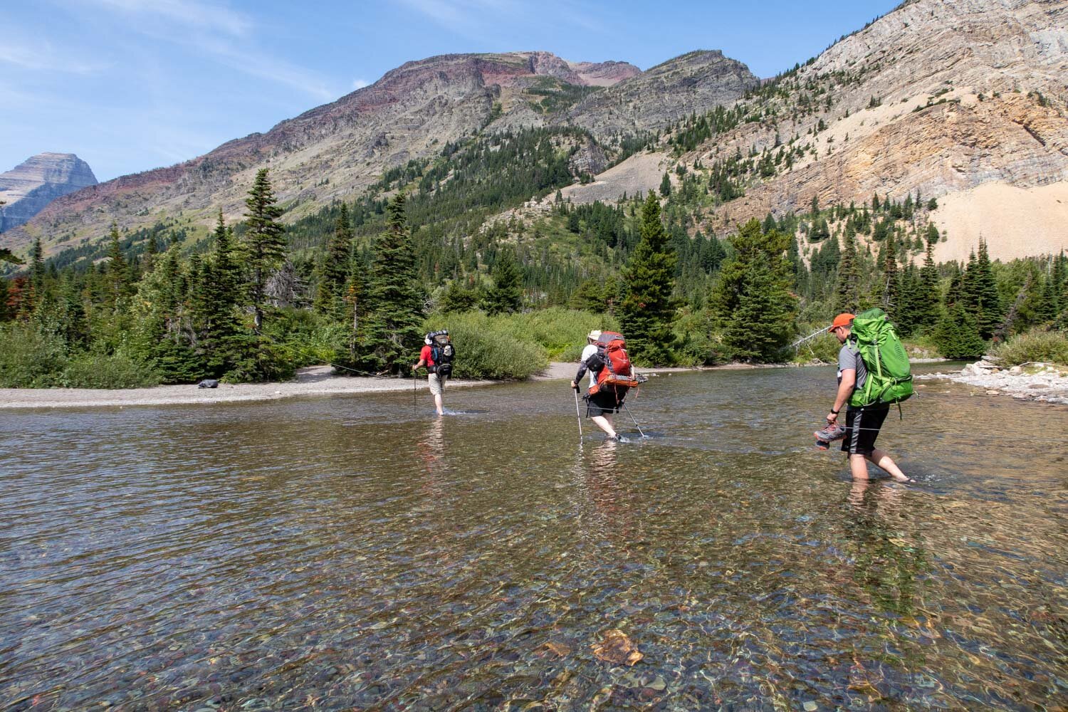
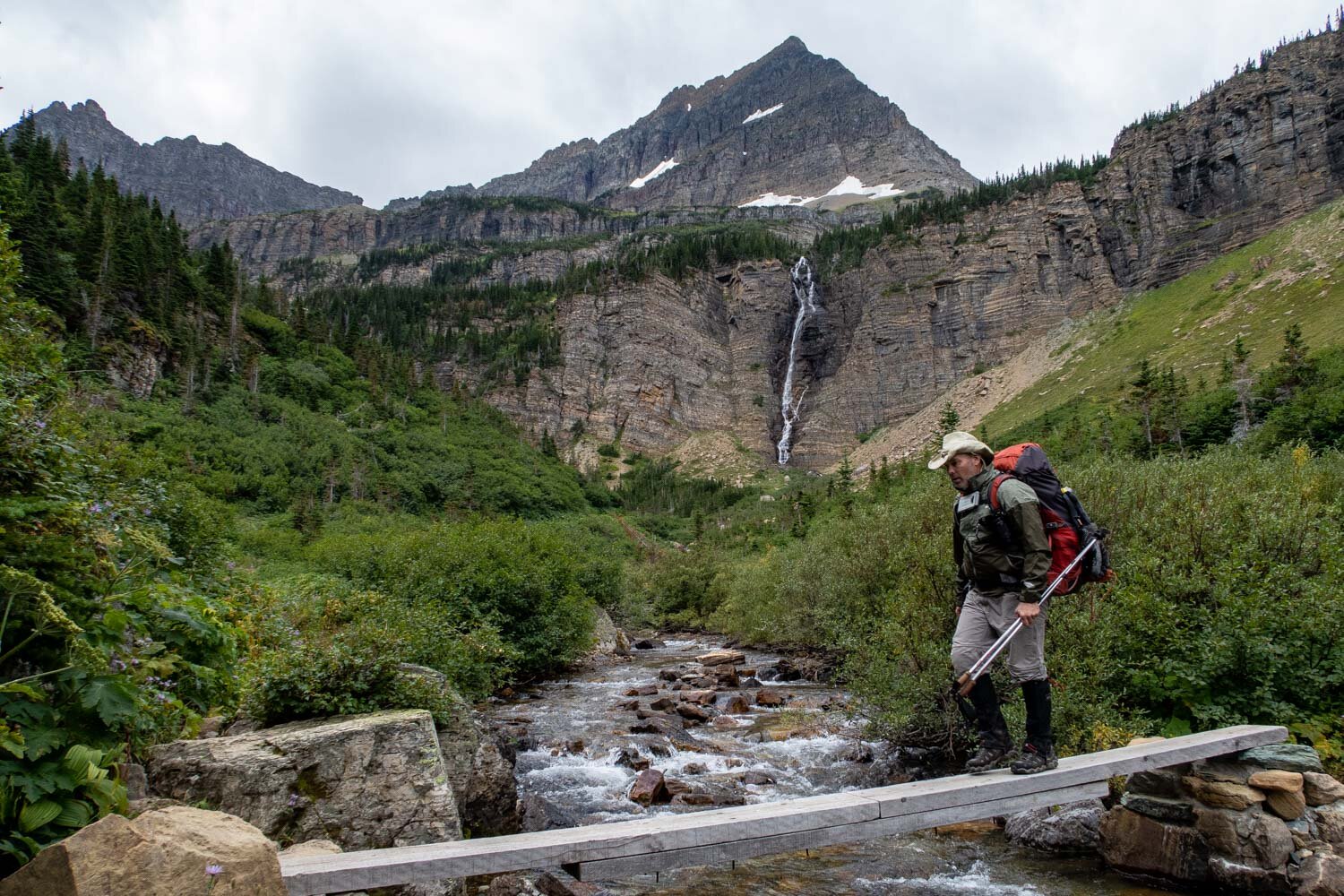
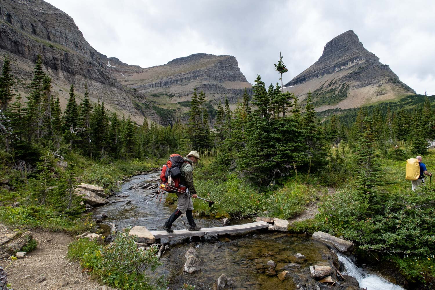
In addition to elevation changes, there are a few stream crossings on this route where you will have to get your feet wet. The largest one is at the Mokowanis River. It’s approximately a 50-yard water crossing, with the water level reaching about the mid-calf height. So, nothing to write home about, but defiantly something you will want to prepare for. One way to do this is to bring lightweight, quick-drying trail runner shoes, like the Altra Lone Peak 9 Shoes. Check out the interactive map below for the location of this water crossing.

Hiking up to Ptarmigan Tunnel
Dangers
Glacier is relatively a safe place to backpack. However, there are some things to beware of so you don’t unknowingly put yourself in a dangerous position. To start with, Glacier is home to around 300 grizzly bears. Unlike black bears, grizzlies (at times) can be aggressive. So it’s important to know how to handle an encounter with one. The National Park Service has an informative video that will help you plan for what to do in an encounter. With that being said, the danger of a bear attack is incredibly low, but it’s always good to be prepared for that possible situation.
Another potential danger is the Ahern Drift on the Highline Trail section of the loop. Here the trail will cling to the side of a steep mountain with a northern exposure. This creates the conditions for an almost permanent snow field directly on the trail. This snow field can linger even into August and often keeps the Northern Highline Trail closed. When it’s eventually opened, there will still be a large drift that you will have to cross. This can be quite hazardous, especially if it's early in the morning or late in the evening when it gets icy. Before heading out make sure to talk to one of the park’s rangers about it’s current status. I have the hazard marked on the interactive map below.
Bugs
Depending on when you go and where you are in the park, insects can be a real nuisance. Both mosquitoes and black flies are present in the early summer, but tend to level off later in the season as most of the snow has melted and standing water dissipates. When I did this trip in the end of August, it was for the most part bug-free. However, to ensure you are well protected on your trip, use a combination of Permethrin on your clothing and bring a small bottle of Picaridin for any exposed skin.

glacier’s atsina lake
Water Sources
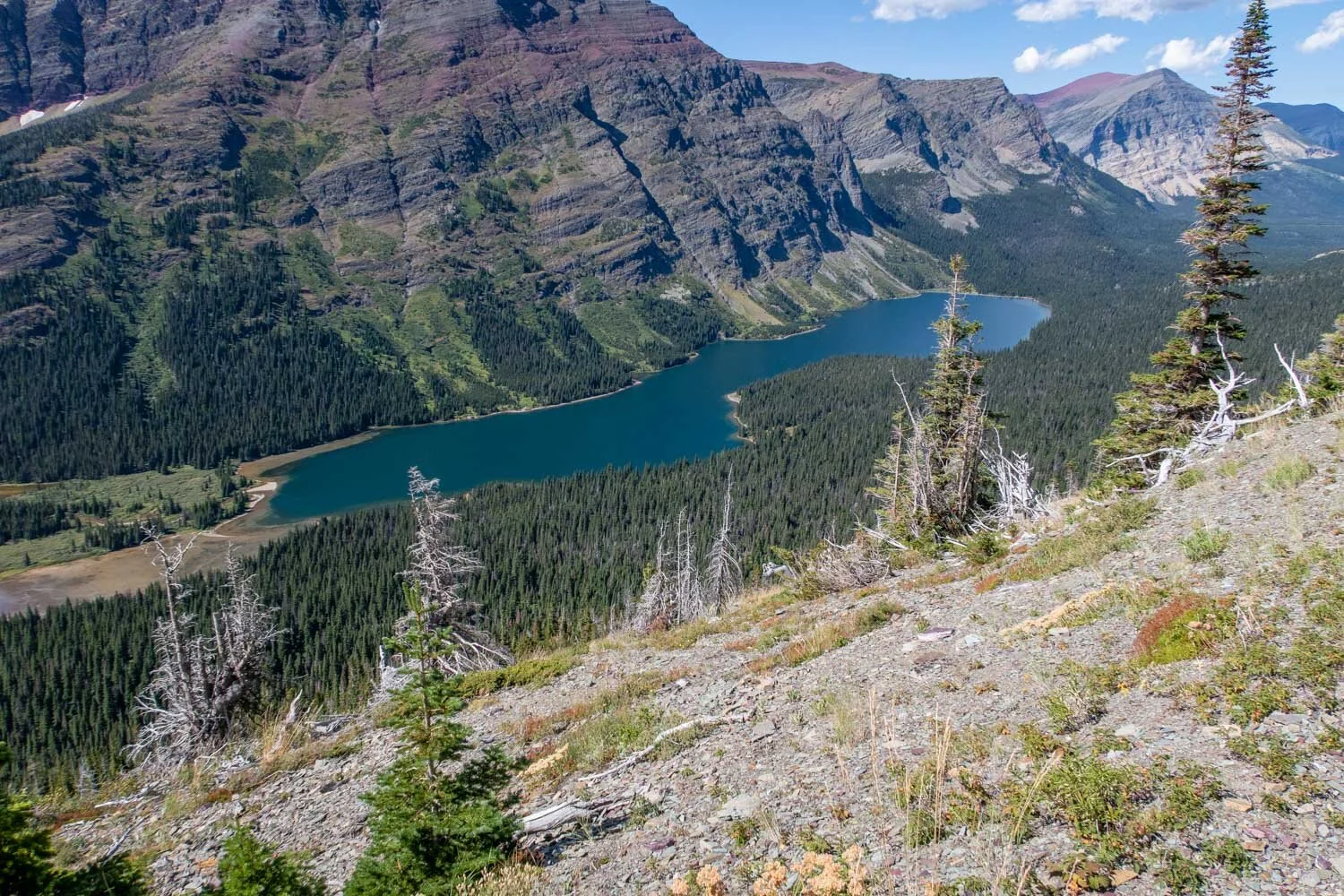
On this backpacking route there’s an abundance of water sources in the form of glacial fed streams, ponds, and lakes only short distances apart. Because of this I would recommend only carrying 2 liters of water at one time and in some areas you could get away with even less to save weight in your pack. Coming up with a water plan for this hike will be fairly straightforward. Check out the map below to see where the water sources are located. Make sure to always filter your water because giardia and bacteria are a concern. One of the best water filters on the market is the Sawyer Squeeze because it’s lightweight and has a fast flow rate.
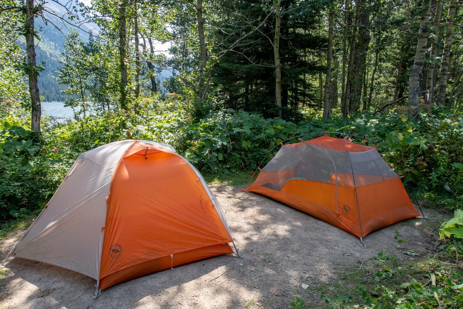
Backcountry Campsites
Each backcountry camping area consists of several camping spots, a food prep area, and an outhouse. When you arrive at the camping area a map will show you the general layout. The food prep area has logs to sit on and has either bear boxes or poles to hang your bear bag from so your food is protected. Below are some rules and regulations to follow when camping in the backcountry.
No food or items with any kind of odor are aloud at the camping area
Cooking is to be done at the food prep area only
Campfires are prohibited at most sites
Only 2 tents are allowed per campsite
No more then 4 people to a campsite
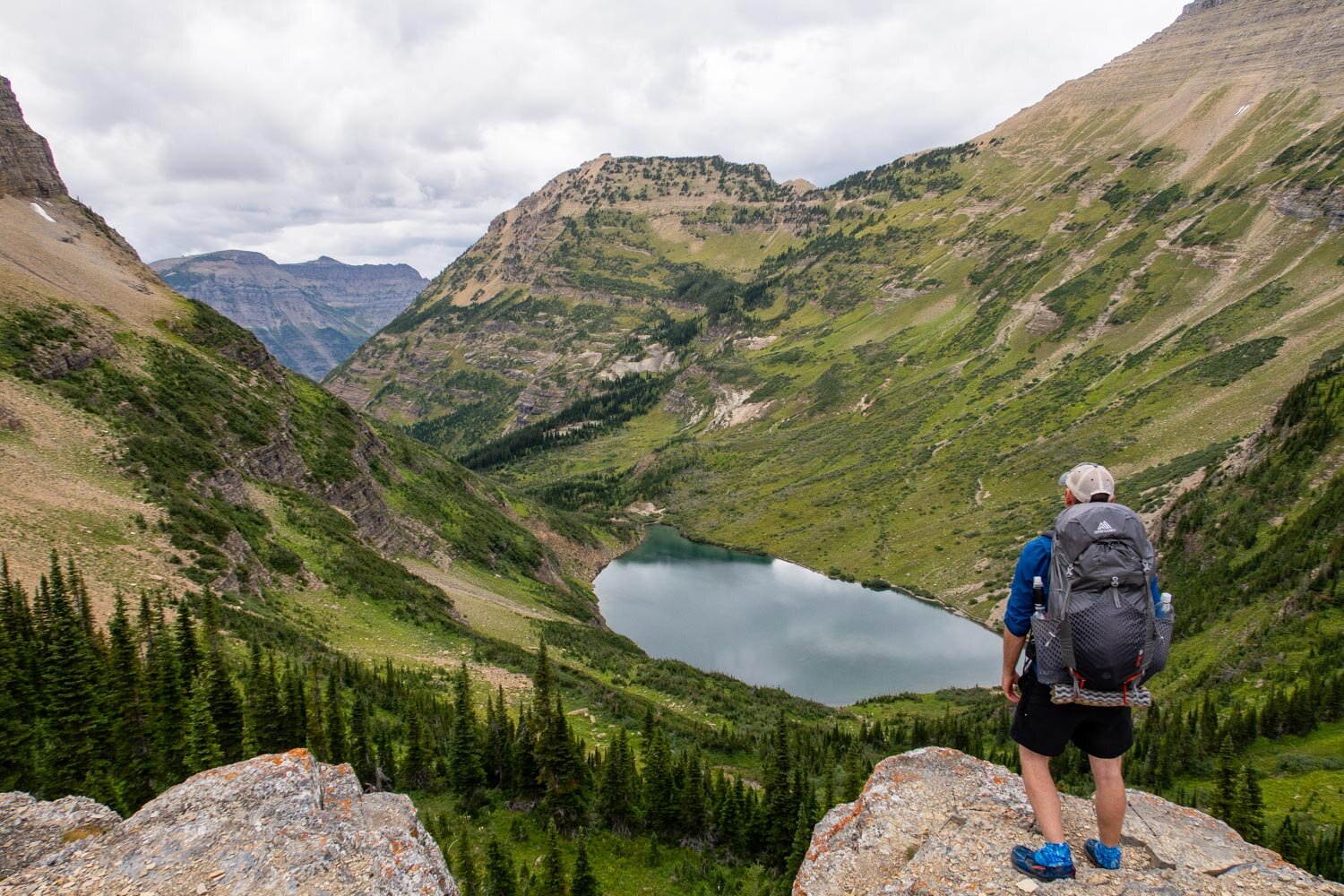
There are many good backcountry campsites to choose from on this route, but my favorite one has to be at the foot of Elizabeth Lake (ELF). Besides a nice camping area, you have the added bonus of enjoying the sights and sounds of Elizabeth Lake on a gravel shoreline. In the evening, as the sun starts to go down, the water will become glass-like and reflect the mountains in the background. Then you will hear the beautiful, wail of the loons. It’s an experience you will never forget.
One of many backcountry campsites in glacier

ELIZABETH Lake’s Backcountry campsite Food Prep area
Backcountry Camping Permit Process
To camp in Glacier’s backcountry, you are required to get a permit. You can obtain a permit by one of two ways. Either by reserving one in advance or you can take a chance and try for a walk-in permit which is ‘first come, first serve.’ Glacier allocates 70 percent of its permits for advanced reservations and 30 percent for walk-ins.
Advanced Reservations
For reserving backcountry campsites in advance, Glacier National Park has an early-access lottery system. It’s held on March 1 for large groups of 9-12 campers or March 15 for smaller groups of 1-8 campers. You can enter into the lottery anytime during the 24-hour period on those dates.
The National Park uses Recreation.gov online platform for the lottery. You must first create an account on the website, then you can enter the lottery. Once the acceptance period has ended, applicants will be selected in a randomly sequenced order. If your name is chosen, then you’ll be assigned a date and time between March 21 and April 30 when you can access your Recreation.gov account and submit your backcountry camping itinerary.
Before your assigned date you can figure out where you would prefer to camp by looking at the Glacier National Park’s backcountry campsite map on their website. One thing to keep in mind for advanced reservation applications is that you’re limited to 16 miles a day between campsites
When it comes time to pick your itinerary, Recreation.gov will show you what backcountry campsites are available in real time. It’s best to be flexible and have several possible itineraries at the ready, because, your first choice may be unavailable.
After the early-access lottery reservation period closes, general reservations open up for all remaining backcountry campsites on May 1 and run to September 30. There is a non-refundable $10 fee for a lottery application or for any permit issued. Also, there is a camping fee of $7 per night, per person which is due when you pick up your permit at the office.
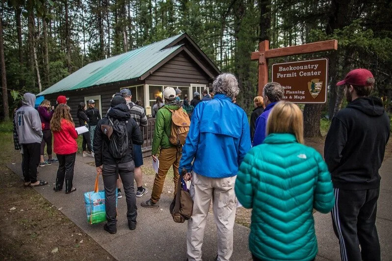
Walk-in Permits
If you’re unable to secure an advanced reservation online, you can always try to attain a walk-in permit. With the park having over 700 miles of trails the chances are very good you can come up with some sort of backpacking itinerary.
To have success in securing a walk-in permit, arrive early the day before you want to start your trip. The backcountry permitting locations open at 7 am every morning, however I suggest getting there an hour before they open because competition is quite high during peak season and there will definitely be a line prior to the opening of the doors like you see pictured below.
The availability of backcountry campsites will be set everyday at 4:30 pm for the following day. You will want to visit the What's available tonight? page on the Glacier Backcountry Site before going to a permit office the next morning. Make sure to also have a Plan B written down in case your first choice doesn’t work out.
Permitting Locations:
Apgar Backcountry Permit Center: Open daily from June 1–September 30 / 7 am–4:30 pm
St. Mary Visitor Center: Open daily from May 26–Sept. 27 / 7 am–4:30 pm
Many Glacier Ranger Station: Open daily from May 26–September 29 / 7 am-4:30 pm
Two Medicine Ranger Station: Open daily from June 1–September 27 / 7 am–4:30 pm
Polebridge Ranger Station: Open daily from May 26–September 29 / 9 am-4:30 pm
Apgar Backcountry Permit Office
Possible Trip Itineraries
5 Day Trip Option
Day 1:
Start at the Iceberg Ptarmigan Trailhead (Check map below for exact location)
Hike for 10.5 miles
Camp at Elizabeth Lake FT (ELF)
Day 2:
Hike for 14 miles
Camp at Stoney Indian Lake (STO)
Day 3:
Hike for 8.2 miles
Camp at Fifty Mountain (FIF)
Day 4:
Hike for 11.9 miles
Camp at Granite Park (GRN)
Day 5:
Hike for 7.6 miles
Arrive back to the Iceberg Ptarmigan Trailhead
6 Day Trip Option
Day 1:
Start at the Iceberg Ptarmigan Trailhead (Check map below for exact location)
Hike for 10.5 miles
Camp at Elizabeth Lake (ELF)
Day 2:
Hike for 7.8 miles
Camp at Glens Lake HD (GLH)
Day 3:
Hike for 6.2 miles
Camp at Stoney Indian Lake (STO)
Day 4:
Hike for 8.2 miles
Camp at Fifty Mountain (FIF)
Day 5:
Hike for 11.9 miles
Camp at Granite Park (GRN)
Day 6:
Hike for 7.6 miles
Arrive back to the Iceberg Ptarmigan Trailhead

Click Here
to open an interactive caltopo map